Stockpile Volumetrics: Aggregates & Mining
Survey-grade stockpile volumes measured from the air: every pile on the yard, reported on a repeatable schedule, with no one climbing the material.
Every pile bounded, measured, and dated.
One flight becomes a survey-grade 3D model of the whole pit. Each stockpile is auto-segmented toe-to-peak and computed to ±1%, on a repeatable schedule — with no one climbing the material.
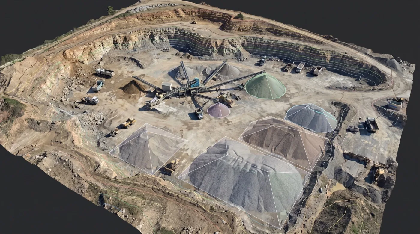
- Stockpile volume14,200 yd³ · ±1%
- Auto-segmented piletoe-to-peak
- Bench contours2 ft interval
- Live asset mapplant + haul fleet
- Haul-road gradeGNSS-traced
Material sitting in piles is money on the books: and the fastest way to measure it is from the air. Skyflex flies your yard, quarry, or terminal, reconstructs a survey-grade 3D surface of every pile, and reports the volumes your inventory, audit, or pay application needs: without a ground crew walking the site or anyone climbing the material.
How an aerial volumetric survey works
We fly a tight overlapping pattern over the site and reconstruct a precisely scaled 3D model of every surface: photogrammetry when the material is open and clearly visible, LiDAR when vegetation or site conditions demand it. Each pile’s toe is defined against the base surface, and its volume is computed directly from the model, using the same documented method on every capture.
What we deliver
- Per-pile volume report, with each pile identified on a labeled map of the site
- Georeferenced orthomosaic in GeoTIFF: the top-down map of the whole yard, every pixel measurable
- Surface model and image-derived point cloud for your own QA and takeoffs
- Change comparison against a prior capture, when a baseline exists
- Exports in the formats your inventory workflow expects
Inventory on a repeatable cadence
A one-off measurement settles a question; a cadence runs an operation. Monthly or quarterly captures reuse the same flight plan, the same base surfaces, and the same reporting format, so period-over-period changes reflect the material: not the measurement method. Ground control can be added where financial reconciliation demands it.
No one on the pile
Walking a stockpile with a GPS rover puts someone on loose, unstable material around active loader traffic. An aerial survey measures the entire yard from above: production never pauses, and nobody sets foot on the pile.
Who buys volumetric surveys
Aggregate producers, mining and quarry operations, bulk-material terminals, municipal and DOT yards, and construction teams reconciling earthwork quantities. If material sits in piles and someone has to answer for the tonnage, this is the survey that answers.
The questions buyers ask first
- How is each pile’s volume actually computed? Each pile’s toe is defined against the base surface and its volume is computed directly from the reconstructed 3D model, using the same documented method on every capture.
- Photogrammetry or LiDAR? Photogrammetry when the material is open and clearly visible; LiDAR when vegetation or site conditions demand it.
- Can we compare one period against the last? Yes. Repeat captures reuse the same flight plan, the same base surfaces and the same reporting format, so period-over-period change reflects the material rather than the measurement method.
- Is it defensible for inventory audit or financial reconciliation? Ground control can be added where financial reconciliation requires it, and every capture is reported with the same documented method.
- Does anyone need to be on the piles? No. The whole yard is captured from the air with no ground crew walking the site and nobody climbing the material.
Related services
Digital Twin Creation
Sensor-fused 3D replica of an asset. Updated on schedule. Web viewer + BIM-ready exports. Learn moreLiDAR Scanning & 3D Mapping
Survey-grade aerial LiDAR. Sees through canopy to bare earth. Classified point cloud, DTM, DSM, contours. Learn moreBridge & Infrastructure Inspection
Drone-captured visual layer for NBIS inspections. Defect imagery indexed to element and span. Learn moreReady to start your mission?
Our FAA-certified pilots are ready to deploy. Get your free site assessment today.